Relief Maps Review
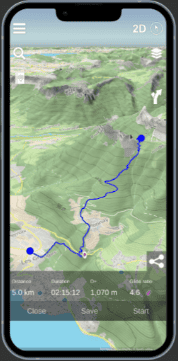
Relief Maps is a versatile mapping and navigation app designed for outdoor activities, including skiing, hiking, mountaineering, and paragliding. It offers 3D topographic maps, route planning, weather forecasts, and live tracking, making it a reliable companion for exploring mountainous terrains.
The app provides access to detailed maps and route data, allowing users to navigate even in remote areas without internet access.
For the whole scoop, keep reading, or listen to our full review right here:
Features and Functionality
Key Features:
- 3D Terrain Visualization: Users can view detailed 3D maps, which help in planning routes by visualizing elevation changes and terrain features.
- Offline Maps: Download maps for offline use, ensuring navigation even in areas with no internet connectivity.
- Route Planning & GPX Integration: Plan routes, mark points of interest, and import/export GPX files for custom navigation.
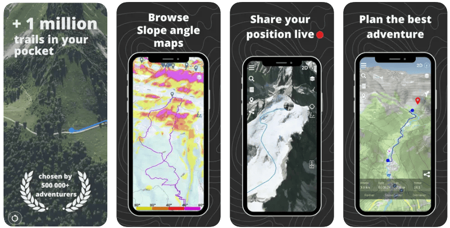
- Live Tracking: Share your location in real-time with friends or family for safety, especially useful for backcountry skiing and solo adventurers.
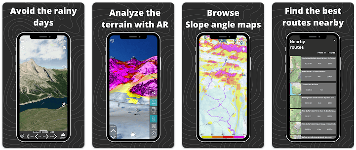
- Weather & Avalanche Data: Access weather forecasts, snow reports, and slope maps to assess avalanche risks, essential for ski touring.
Best Use Cases
Who is this app for?
Relief Maps is ideal for skiers, snowboarders, hikers, and outdoor enthusiasts who require detailed maps for navigating off-piste or backcountry areas. It’s especially beneficial for those venturing into less-charted territories or planning multi-day trips.
The app’s features are tailored to enhance the experience of these activities and provide users with valuable tools for navigation, planning, and safety.
Some of the outdoor sports that Relief Maps caters to:
- Hiking and Trekking: The app’s route creation feature, which provides estimates for distance, altitude difference, and travel time, makes it an ideal tool for planning and navigating hikes and treks. The database of over 1 million routes also provides hikers and trekkers with a wealth of options to choose from.
- Trail Running: The app’s 3D maps, which provide a clear and detailed view of the terrain, are helpful for trail runners who need to be aware of their surroundings. The live tracking feature can also be used to share a runner’s location with others, providing an added layer of safety.
- Skiing: While not explicitly stated in the sources, the inclusion of skiing in Relief Maps’ tagline suggests that the app is also suitable for skiing. The 3D maps would be beneficial for skiers navigating mountainous terrain.
- Paragliding: Similar to skiing, paragliding is mentioned in the app’s tagline. The app’s features, such as live tracking and route creation, could be useful for paragliders who need to plan their flights and monitor their location.
When should you use this app?
Use Relief Maps during your ski tours, off-piste adventures, or when planning outdoor activities where precise navigation and safety information are crucial.
Why We Love Relief Maps
- Reliable Offline Functionality: The ability to download and use maps offline is essential for users exploring remote locations.
- 3D Maps & Visualization: Detailed terrain views help in understanding the landscape, making it easier to plan safe and effective routes.
- Safety-Focused Features: The app’s integration of weather forecasts and avalanche slope maps ensures users have the information they need to make informed decisions.
Pros and Cons
Pros:
- Comprehensive mapping with various layers, including avalanche slope maps.
- Offline capabilities make it reliable in remote locations.
- Supports multiple outdoor activities, not limited to skiing.
- Easy-to-use live tracking feature for added safety.

Cons:
- Some features are only accessible with a premium subscription.
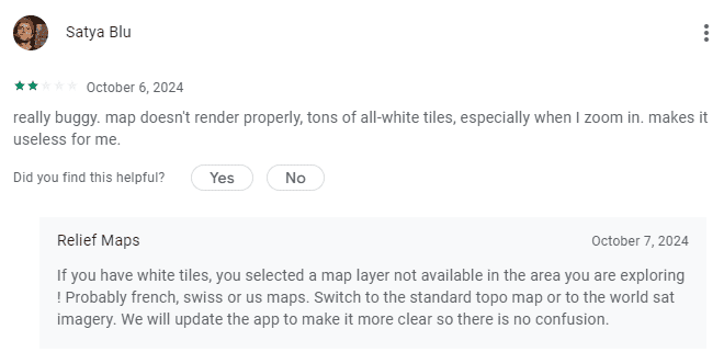
- Occasional issues with map loading, especially on older devices.
- Requires a learning curve for users new to advanced navigation apps.
User Experience and Interface
Design and Usability:
The app is user-friendly with a clean interface, though its detailed features may require some familiarization. The 3D maps are easy to navigate, and the route planning tools are intuitive, making it straightforward to set up routes and mark important points.
Performance:
Relief Maps generally performs well, though high-resolution 3D maps can demand more processing power. Users are advised to pre-download maps to ensure smooth operation during their trips.
Compatibility and Pricing
Platforms Supported:
Free vs Paid Version:
- Relief Maps can be used for free, but advanced features, including offline maps, live tracking, and premium map layers (such as IGN maps), require a subscription. Premium plans are available monthly and annually, with options for a lifetime purchase.
In-App Purchases:
- Premium subscriptions range from around $25 to $45 per year, with discounts for longer commitments or bundled packages.
Real User Reviews
What users are saying:
“A great app for planning ski tours. I used it to navigate a multi-day hike and it worked flawlessly.”
– 5-star review on App Store

“Very useful for backcountry skiing, though sometimes the map tiles take a while to load.”
– 4-star review

“The live tracking feature helped reassure my friends while I was exploring a new route.”
– 4.5-star review
Overall Rating:
4.6/5 stars based on user feedback on major app stores.
How to Get Started with Relief Maps
Step-by-Step Guide
- Download: Get Relief Maps from the iOS App Store or Google Play Store.
- Create Account: Set up your profile and configure your settings for preferred map layers.
- How to Use: Start planning your routes, download maps for offline use, and enable live tracking when heading out for additional safety.
Similar Apps
- FatMap – Now integrated into Strava, offers 3D terrain maps for outdoor sports, including skiing and snowboarding.
- Gaia GPS – Known for topographic maps and comprehensive backcountry navigation.
- onX Backcountry – Specialized in detailed mapping with avalanche safety features and backcountry routes.
Final Verdict
Relief Maps stands out for its detailed 3D mapping, offline capabilities, and user-friendly design. It is particularly suited for backcountry skiers, hikers, and mountaineers who need reliable navigation tools. With safety-focused features like avalanche risk assessment, it offers valuable assistance for those tackling more adventurous routes.
Download Relief Maps Today

Planning your next adventure? Download Relief Maps and explore the mountains with confidence!
