2024 Update: FatMap and Strava joined forces in January 2023. On October 1st, 2024, Strava discontinued the FatMap 3D mountain mapping and navigation app.
What to Expect: FatMap’s Transition to Strava
This audio podcast explains the key changes FATMAP users can expect as the service integrates with Strava:
Here are the key changes to FATMAP:
FATMAP app and website retirement: The FATMAP app and website will be retired on October 1, 2024. After this date, the app will remain on your device but will be unusable.
Feature integration with Strava: Strava is prioritizing the integration of FATMAP’s 3D maps and terrain tools into its platform. FATMAP’s 3D map is already available in Strava’s Flyover feature, with the ability to pause and modify flight speed. FATMAP’s 3D map images are also visible in the Strava feed.
Route content migration: FATMAP route content, excluding user-generated content, will be moved to Strava. Users can proactively transfer their routes from FATMAP to Strava before October 1st using a data tool. Only the route title, description, and route line can be transferred. To retain other information like assigned grades and photos, users need to export them separately.
Features not immediately available in Strava: Some FATMAP features will not be available in Strava in time for the coming northern hemisphere winter, including:
- Waypoints
- Personal guidebooks
- National topo maps (including IGN and OS maps)
- Offline map downloads of the FATMAP map
- Live snow and piste information
Data transfer and deletion: Users can transfer their Routes to Strava using a data tool. Adventures, Guidebooks, and Waypoints cannot be transferred; users must download them using a provided tool. All account data should be exported before October 1st, after which it will be permanently deleted. Account data can be exported multiple times, but no more than once per day. Only user-created routes are included in the export; routes created by others and saved in guidebooks will not be included. Users can export their account data and delete their account via the FATMAP website or the Settings menu in the mobile app.
FATMAP Explore membership: Users with a FATMAP Explore membership linked to their Strava subscription will continue to enjoy certain FATMAP features on Strava. However, their access to the FATMAP app and website will end on October 1st. Explore privileges will not remain valid after October 1st; users need to collect their codes and use them before that date.
Subscription voucher and refund: FATMAP Explore members whose subscriptions do not include Strava will receive a 6-month Strava subscription voucher. They are also eligible for a prorated refund if their paid subscription period has not expired. Refund requests should be sent to explore@fatmap.com.
Pro account transition: The FATMAP Pro Access program will not continue. However, Pro users may be eligible for a Strava Pro Badge.
You can find further information on using routes in Strava on their website and in the app. There is also information available on how to make a route available offline and follow it in the Strava app. Instructions for exporting a route to a GPS device or as a GPX file are also available.
Former FatMap Review
FatMap is a high-resolution 3D mapping and navigation app designed for outdoor enthusiasts, including skiers, snowboarders, hikers, and mountain bikers.
With detailed topographic maps, real-time GPS tracking, and route planning capabilities, FatMap provides everything you need to explore the backcountry safely and confidently.
Whether you’re navigating ski resorts or planning an off-piste adventure, FatMap’s stunning 3D maps help you visualize the terrain, assess risks, and discover new routes.
Features and Functionality
Key Features:
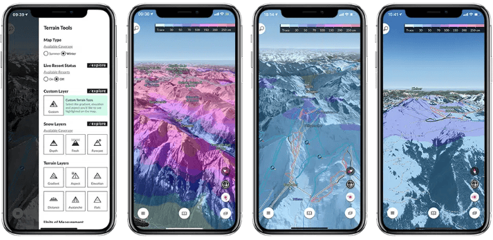
- 3D Mapping: FatMap offers high-resolution 3D maps of mountains, ski resorts, and off-piste terrain, allowing users to see detailed terrain features like cliffs, ridges, and slopes.
- Route Planning: Plan your ski routes or backcountry adventures with ease using the app’s built-in route planning tools, which help you assess elevation, distance, and difficulty.
- GPS Navigation: Real-time GPS tracking keeps you oriented on the slopes and ensures you stay on track during your adventures.
- Safety Tools: FatMap provides essential safety features, including avalanche risk zones, slope gradient analysis, and weather data, to help you make informed decisions in the backcountry.
- Offline Maps: Download maps for offline use, ensuring you have access to essential navigation tools even in areas without signal.
Best Use Cases
Who is this app for?
FatMap is ideal for advanced skiers, snowboarders, and backcountry explorers who want to venture beyond the resort boundaries. It’s perfect for those who need detailed maps, real-time GPS navigation, and safety features to help them navigate challenging terrain.
When should you use this app?
FatMap is best used during backcountry ski trips, off-piste explorations, and resort skiing when you want to plan your routes and visualize the terrain in 3D. It’s particularly useful for assessing avalanche risks and navigating remote areas with no cell signal.
Why We Love FatMap
- Detailed 3D Maps: The high-resolution 3D maps are incredibly detailed, allowing you to visualize every aspect of the terrain, including cliffs, slopes, and ridges.
- Backcountry Safety: With features like slope gradient analysis, avalanche warnings, and real-time weather updates, FatMap helps users make safer decisions in the backcountry.
- Offline Navigation: The ability to download maps and use them offline is essential for exploring remote areas where mobile signal is unreliable.
- Versatile for All Outdoor Activities: While ideal for skiing and snowboarding, FatMap also works for hiking, mountain biking, and other outdoor adventures.
Pros and Cons
Pros:
- Stunning high-resolution 3D maps.
- Safety features like slope gradient and avalanche risk data.
- GPS navigation and route planning for backcountry skiing and other activities.
- Offline maps for use in remote areas.
Cons:
- Premium features require a subscription.
- Limited social or community features compared to other apps.
- May have a steep learning curve for beginners unfamiliar with topographic maps.
User Experience and Interface
Design and Usability:
FatMap’s user interface is sleek and visually appealing, with the 3D map feature being the app’s standout element. The maps are easy to zoom and rotate, providing a full understanding of the terrain. The route planning tools are user-friendly, though beginners might need some time to get accustomed to the detailed map data.

Performance:
The app performs well in most conditions, especially when using offline maps. However, some users report occasional slowdowns when loading high-resolution maps in real-time, especially in areas with poor signal.
Compatibility and Pricing
- Platforms Supported:
- Available on iOS and Android.
- Free vs Paid Version:
- The free version includes basic access to maps and tracking features, but most of FatMap’s premium features, like offline maps and safety tools, require a subscription.
- Premium Pricing: FatMap’s premium subscription is available for $29.99/year, unlocking full access to 3D maps, offline mode, route planning, and safety tools.
- In-App Purchases:
- Premium subscription to access advanced features like slope gradient analysis and offline maps.
Real User Reviews
What users are saying:
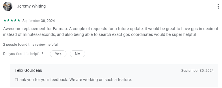
“FatMap is a game-changer for backcountry skiing. The 3D maps make route planning so much easier.”
– 5-star review on App Store
“The offline maps are essential when you’re deep in the backcountry without cell service. It’s a must-have app for explorers.”
– 5-star review on Google Play
“The app is fantastic, but some of the premium features should be available for free, especially safety tools.”
– 4-star review on Google Play
Overall Rating:
4.7/5 stars based on user reviews.
How to Get Started with FatMap
Step-by-Step Guide:
- Download: Download FatMap from the iOS App Store or Google Play Store.
- Sign Up: Create a FatMap account and choose between the free version or upgrade to the premium subscription for full features.
- How to Use: Explore the 3D maps, plan your ski routes, and download offline maps for your backcountry adventures. Use GPS navigation and safety tools to stay informed during your trip.
Alternatives to FATMAP
- Ski Tracks – Tracks your skiing stats and performance offline, offering detailed analytics for any resort.
- Powder Project – Provides detailed routes for off-piste skiing with safety features and powder forecasts.
- Slopes – Offers real-time tracking with a focus on stats and 3D map playback, ideal for in-bounds skiing.
- Strava – The new FatMap – Strava works with your phone or GPS device to track your activities and enables you to share what you’re doing with friends.
- OUTMAP – OUTMAP is a versatile mapping application tailored for outdoor enthusiasts engaging in activities such as hiking, biking, and skiing, including backcountry skiing.

Final Verdict
FatMap is an essential app for serious skiers, snowboarders, and outdoor adventurers who need detailed maps, GPS tracking, and safety tools. Its high-resolution 3D maps and offline capabilities make it invaluable for backcountry skiing, allowing users to visualize the terrain and assess risks in real-time. While many features require a premium subscription, the value FatMap offers for route planning, safety, and exploration is unmatched for those venturing off-piste or into remote areas.
